REFORM Newsletter No 6 - March, 2015

Welcome editorial by the REFORM Coordinator

Dear reader,

The sixth REFORM newsletter informs you about our events in 2015, summarises the newest deliverables, interviews Peter Pollard (SEPA) on how to tackle hydromorphological issues and presents PhD studies and the Swiss restoration case study in the River Thur. The 4-yr REFORM project started in November 2011 and is now already in its final year. This year the emphasis is on making our results available for application after 3 years of work that were mostly dedicated to compiling relevant existing and generating new scientific knowledge. Our current focus on application goes hand in hand with a number of events that REFORM organises and supports.

For young scientists and Ph.D. students a summer school on "Restoring Regulated Streams Linking Theory and Practice" is organised (27-29 June 2015, Wageningen, the Netherlands). The summer school is immediately followed by our International Conference “Novel Approaches to Assess and Rehabilitate Modified Rivers” from June 30 to July 2, 2015, also to be held in Wageningen. The programme of the conference will feature 13 excellent keynotes and over 50 regular presentations. The registration is open and special hotel rates are available until early May. If you are interested then do not wait too long to register and visit the conference website. In September 2015, REFORM will also organise a workshop by invitation to address sediment management in connection with environmental flows. Finally, the working group ECOSTAT of the WFD Common Implementation Strategy plans to host a workshop on hydromorphology in connection to ecological status in October 2015 to which REFORM will contribute.

Since our last newsletter, the following deliverables are now ready and available on our website:

  • D3.2 Biological responses to degraded hydromorphology and multiple stress
  • D4.3 Effects of large- and small-scale river restoration on hydromorphology and ecology
  • D4.4 Assessing social benefits of river restoration

We invite you to consult these deliverables and hope they are of use to your work. Of course, we welcome feedback on our results. Three deliverables are introduced in separate items of this newsletter. The role of vegetation in “Plants as physical ecosystem engineers” (based on D2.2), the benefits of type and scale of restoration projects in “Effects of restoration on hydromorphological and biological response variables and factors influencing restoration outcomes” (based on D4.3) and synergy and trade-offs of restoration with other demands in “Synergistic approaches to river restoration” (based on D5.3 that will be available late March/early April).

Figure 1: Plants as ecosystem engineers: aquatic vegetation directs the flow in small streams (Photo: Tom Buijse)

Within REFORM young scientists are given the opportunity for Ph.D. research. In this edition, two Ph.D. students present their work: Luiza Tylec (Poland) investigates the valorization of restored wetlands ecosystem services to support better decision making in restoration planning and Benjamin Kupilas (Germany) studies the benefits of stream restoration on the food-web structure and the self-purification potential.

REFORM has organised several events for stakeholders (see previous newsletters). The most recent workshop was held in Kuwasy (Biebrza Valley, Poland) on September 15-17, 2014. The workshop focused on the role of groundwater for river – floodplain ecosystems and brought 18 invited experts from Denmark, England, Germany, The Netherlands, Poland, Scotland, Spain and Sweden together. The aim of the workshop was to critically review the European level to consider groundwater-surface water interactions in the practice of water management and environmental policy implementation. The conclusions will be made available soon in a policy discussion paper.

The key expert on rivers and river restoration interviewed for this edition of our newsletter is Peter Pollard (Scottish Environment Protection Agency). Peter is one of the key persons within ECOSTAT to progress the debate on hydromorphology. Given that improving hydromorphological status most often implies changes in land use or ownership he advocates building partnerships as the way forward. Peter Pollard is member of the Advisory Board of REFORM and will present a keynote at our conference.


Figure 2: Benefits of protecting near-natural river deltas: ecotourism in the Danube Delta (Romania) (Photo: Tom Buijse)

As always we present one of our case studies on river restoration. This time one of the most prominent examples in Switzerland: widening and rewilding the River Thur. The story clearly demonstrates the improvement of ecological status within the restored stretch, but at the same time puts these benefits into perspective because the 1.5 km project only covers just over 1% of the total 130 km regulated river.

Figure 3: Socio-economic benefits of urban stream restoration in Oslo (Norway): prices of property have risen substantially (Photo: Tom Buijse)

Also this time we hope you enjoy reading our newsletter. Of course, we always appreciate it when you forward our newsletter to interested colleagues. If you have comments or questions then please contact us. At the same time we invite you to contribute. Thus please let us know if you would like to use our website or newsletter to announce an event or present a relevant study or report.


On behalf of the REFORM team,


Tom Buijse

REFORM Coordinator


p.s. If you do not yet receive our newsletter automatically and are interested to do so, then please visit our home page (www.reformrivers.eu) where you can subscribe.

For further information: 

Tom Buijse

Effects of restoration on hydromorphological and biological response variables and factors influencing restoration outcomes

In the context of REFORM WP4, we compiled a harmonized dataset on the effects of hydromorphological river restoration measures on a broad range of response variables including habitat composition in the river and its floodplain, three aquatic and two floodplain-inhabiting organism groups, as well as food web composition and aquatic land interactions as reflected by stable isotopes. Additional data on factors potentially constraining or enhancing the effect of restoration were compiled to identify conditions which favour restoration success. Ten pairs of one large and a similar but small restoration project were investigated to especially address the role of restoration extent for river restoration effects. The restoration effect was quantified by comparing each of the 20 restored river sections to a nearby non-restored, i.e. still degraded section.

Figure 1: General study design of the paired restored sections (Deliverable D4.3 of the REFORM consortium)

Main results and conclusions

Restoration effects differed between organism groups and were highest for ground beetles and macrophytes, moderate for fish, and low for macroinvertebrates and floodplain vegetation (the latter usually also showing high effects but being constrained by agricultural land use in our study)

  • More organism groups (aquatic AND semi-aquatic / floodplain inhabiting) should be considered in the monitoring and assessment of river restoration projects.

Restoration had an overall positive effect on hydromorphology, especially on macro- and mesohabitat diversity (e.g. number of islands, bars, pools) but a low effect on microscale substrate composition. Microhabitat diversity was correlated with macroinvertebrate richness and diversity; ground beetle richness was not correlated with habitat diversity but related to specific pioneer habitats.

  • Key indicators for identifying restoration success should include parameters at larger spatial scales such as channel adjustments.
  • While restoration projects like widening are visually appealing and increase macro- and mesohabitat diversity, they potentially fail to increase microhabitat diversity relevant for macroinvertebrates. It is important to ensure that habitats at relevant spatial scales or processes that create such habitats are restored.
  • For some organism groups (e.g. ground beetles), it is more important to re-establish specific pioneer habitats and to restore processes to sustain these habitats over the long-term than to increase the mere number of habitats.

Restoration effects on community structure, traits, and functional indicators were generally more pronounced compared to the effects on species number and diversity.

  • Future restoration projects and monitoring studies should focus more on functional aspects (e.g. species traits, community structure) to investigate functional changes caused by river restoration, infer causal relationships, and identify restoration measures with large effects on ecosystem functions.

Restoration effects depended on the effect of restoration on aquatic substrate diversity, were especially high in widening projects and depended less on catchment land use and restored reach length.

  • Restoration effects were not mainly limited by land use and might have been rather constrained by the limited species pool available for re-colonization since the organism groups which benefited most also have relatively high dispersal abilities (ground beetles, macrophytes). This clearly merits further investigation since it would need a completely different restoration strategy compared to reach-scale habitat improvements.
  • Probably, even the large restoration projects in our study were simply too small to benefit from possible positive effects of restoration extent, an observation which is also supported by other recent studies.
  • The high effect of widening projects is consistent with other studies and the widely endorsed assumption that restoring geomorphological processes has a higher effect compared to other measures. Since widening includes a set of measures, it has to be further investigated which specific measures drive the high effects. Besides, these results do not question the use of instream measures. Several other studies reported positive effects of instream measures, while our study had a relatively low number of instream projects and thus a limited universality.

The 20 restoration projects investigated in this study were representing good-practice examples in Northern, Eastern and Central Europe, reflecting the relatively long tradition in river restoration in these regions. Regional differences have to be considered when applying these results to other river types and regions (e.g. large or Mediterranean rivers).

Further links

REFORM Deliverable D4.3. Effects of large- and small-scale river restoration on hydromorphology and ecology

For further information: 

Jochem Kail (UDE)

Plants as physical ecosystem engineers

In our 3rd newsletter, we highlighted the importance of adopting a hierarchical, multi-scale, approach to river hydromorphological assessment. We explained that this is important because the shape and behaviour of a river, as well as the landforms it creates and the habitats that it supports, are controlled by processes at a wide range of spatial scales. In other words, what we see within a river reach is the result of a cascade of influences from further upstream and downstream in the catchment. Information concerning the REFORM spatial hierarchical framework is now available as Deliverable 2.1, which is comprised of four volumes or parts: an overview of the framework (part 1); some more detailed discussion of some of its components (part 2); and two parts (3 and 4) illustrating applications of the framework to a selection of river catchments from different geographical areas of Europe. The four parts can be downloaded here.

Another crucial aspect of hydromorphology that is too often neglected, is the influence of vegetation on river channel form and dynamics. Riparian vegetation is not included as a biological quality element in the Water Framework Directive, and yet research conducted over the last 20 years has clearly shown that riparian vegetation has a fundamental influence on the hydromorphology of rivers and their floodplains, with a geographically more widespread impact than aquatic vegetation. Within the REFORM project, we have assembled evidence from published sources and available data sets to illustrate how vegetation interacts with hydromorphology to constrain numerous aspects of river morphology and dynamics, so providing a vital component of any river management and restoration efforts. Our findings are reported in Deliverable 2.2 part 1, which can also be downloaded here.

Here, we briefly focus on a conceptual model of vegetation-hydromorphology interactions that we have developed and tested in several catchments across Europe. The model highlights the natural functioning of vegetation as a control on river hydromorphology, indicating that if vegetation is heavily managed, the hydromorphological character of the river will change. If vegetation is allowed to colonise freely, it will accelerate river channel recovery from management interventions.

Vegetation interacts with hydromorphological processes. From one perspective, vegetation is constrained by hydromorphological processes that reflect the climate, moisture availability and physical disturbances to which the vegetation is subjected. These constraints operate over the different spatial scales of the hierarchical, multi-scale framework (Table 1).  Against this background, vegetation within river channels and floodplains is very heavily affected by fluvial disturbances, such that only certain species can colonise the most disturbed parts of the river corridor.

Table 1:  Hydromorphological processes and related factors reflecting climate , moisture availability and degree of fluvial disturbance, that constrain the plant species and communities that can occupy the spatial units found within river catchments.

Spatial scale

Climate

(Biogeographical context; Precipitation and Temperature)

Moisture Availability (in addition to climate)

Fluvial Disturbance

Region

 Macrobioclimates


Catchment

 Thermoclimatic belts

Geology, Topography affecting water retention, deep percolation and aquifers

Location, Geology, Topography affecting regional features

(e.g. droughts, avalanches, mudflows)

Landscape Unit

Mesoclimate (Regional conditions due to elevation, topography)

Geology, Topography and Soil condition, Land cover affecting water infiltration and moisture recharge/depletion

Magnitude, frequency and duration of water and sediment delivery to the river corridor (e.g. magnitude and frequency of droughts, avalanches, mudflows, organic debris flows)

Segment

Meso-climate

(Local conditions due to elevation, topographic orientation, form and setting)

River-floodplain width, hillslope hydrology and river flow regimes. Segment-scale (alluvial aquifer) groundwater - surface water interactions (GSI)

Valley gradient and river entrenchment: river flow and sediment transport regimes (e.g. frequency and duration of floods and droughts, sediment and plant material erosion, transport, storage)

Reach

Micro-climate

(Local conditions due to wind, vegetation transpiration, water bodies evaporation,..)

Cross sectional form and sedimentary structure, texture, permeability. Reach-scale GSI

Channel gradient, size, type – morphology, bed and bank materials(calibre, cohesion, erodibility), stream power in relation to reach-scale water, sediment, plant material dynamics

Geomorphic Unit

Micro-climate

(Point conditions due to vegetation shadow, water depth, updwellings, springs, velocity...)

Microtopography, relative elevation, and distance relative to river bed.  Sediment calibre, organic content, structure, and patch-scale GSI

3D position with respect to active channel, erosion resistance and stability.

Our conceptual model defines up to 5 zones that may be present within a river corridor (Figure 1):

  • In moist environments, a zone of perennially-flowing water is present in the low flow channel (zone 1). Beyond this, the frequency, duration and depth of inundation decreases towards the outer limits of the river corridor (the outer edge of the floodplain and the base of bordering hillslopes).
  • Within zone 2, inundation is frequent, deep, and prolonged, leading to relatively high flow velocities and shear stresses and so a high potential for the flowing water to erode, transport and deposit sediment and also to damage, uproot or bury plants.
  • With increasing distance from the river (zone 3), inundation depth, duration and frequency decrease, reducing the potential for sediment erosion and transport, and leading to a progressive fining of transported and deposited sediment coupled with an increase in its organic content until, in zone 4, sediment dynamics are negligible during inundation.
  • In zone 5, which includes the most elevated areas of the river corridor, and those that are most remote from the perennial channel, inundation is extremely rare and subsurface water dynamics become the dominant control on vegetation.

The relative size of these five zones varies greatly from river source to mouth and with the width of the river corridor. The relative proportions of the river corridor that the zones occupy also vary with the type of river that is being considered (Figure 2).

Figure 1:  Schematic representation of the five zones of natural vegetation- hydromorphology interactions in river corridors of different confinement and width from the source to mouth of a river.


Figure 2:  Schematic representation of the proportions of the width of a floodplain river corridor that may be occupied by the five zones of natural vegetation- hydromorphology interactions according to the type of river channel that is present.

These five zones are subject to different vegetation – hydromorphology interactions, and the nature of the interactions also varies according to the biogeographical region in which the river is located. However, in all cases, there is a critical zone of very tight and strong interactions that is important for understanding the consequences of vegetation management and recovery for river channel form and adjustment. This critical zone bridges river corridor zones 1 to 3 and is a zone where certain plant species can act as physical ecosystem engineers, colonising bare river sediment surfaces and then trapping transported sediments as the plants grow. In this way, the plants create landforms that can then be colonised by other plant species.  Riparian tree species and rigid, emergent, aquatic plant species can often take on this role, and very large pieces of dead wood can often contribute by acting as retention structures for plant seeds and plant fragments that can sprout.

The engineer plants and the landforms that they create are located in the critical zone of intense plant-hydromorphology interactions, where they may be removed by the force of extreme floods but where they also colonise eroded areas and extend towards and into the channel during periods of less intense river flow disturbances. If these plants and any associated wood pieces are removed or cut back, this allows fluvial processes to push back the leading edge of the vegetation, increasing river bank erosion, widening the channel, and reducing the habitat complexity of the river channel and its riparian margins. In severe circumstances this can lead to a change in river type. For example, in extreme cases river channels have been observed to change from single thread to braided as a result of degradation of floodplain vegetation cover.

The photographs in Figures 3, 4 and 5 illustrate a small sample of the landforms that plants can create within the critical zone of the river corridor. The presence of such pioneer vegetated landforms, indicates the leading edge of vegetation-hydromorphology interactions that is so critical for river size and dynamics, and also for the diversity of the habitat mosaic that is available within the river ecosystem.

Figure 3: Early stage landforms built around sprouting uprooted trees, branches and tree seedlings. A. Pioneer island centred on a single uprooted and deposited tree. B. a building island which forms when a feature similar to A traps large quantities of fine sediment and grows through the sediment to form a large mound-like feature. C. a levee-like feature created by fine sediment accumulating around a line of tree seedling at the edge of the low flow channel. D. sprouting uprooted trees and branches trapping sediment and growing to give a sequence of ridges of increasing size and tree age parallel to the edge of the channel and usually on the inside of river bends (photos: Angela Gurnell).

Figure 4:  An evolutionary sequence of landforms created by emergent aquatic plants trapping and reinforcing fine sediment. A. a submerged shelf of fine sediment on the channel bed, formed around the base of a stand of aquatic plants. B. a submerged shelf, similar to A. but retained by tussock-forming aquatic plants. C. a berm formed by further sedimentation of features such as those in A and B, but now the sediment surface has aggraded to the low flow water surface level. D. a bench formed by further sedimentation of a berm feature such as that in C so that the surface is now located well above the low flow water surface level (photos: Angela Gurnell).

Figure 5: A. vegetated bars and islands created by sediment trapping and reinforcement by aquatic plants in a similar manner to the features shown in Figure 5. B. a river bank composed entirely of decaying plant material and reinforced by aquatic and wetland plants (photos: Angela Gurnell).

For further information: 

Angela Gurnell (Queen Mary University of London)

Synergistic approaches to river restoration

Drivers of river restoration

The growing human population and ever advancing social and economic development have led to a massive demand on freshwater resources, especially through agricultural and urban land use change that result in actions such as water resource management, flood protection, navigation and hydropower. These developments have put considerable pressure on our rivers and are altering their natural functioning through channelization, disruption of the river pathways,disconnecting channels from flood plains,impoundment, water abstraction and flow regulation. Moreover, global effects of climate change are becoming more evident and will have a major impact on water resources in Europe, intensifying the effects of river degradation and changing the way river restoration is applied.

There are a number of European Directives in place to support the ecological health of rivers such as the Water Framework Directive (WFD (2000/60/EC), Habitats Directive (92/43/EEC) and Groundwater Directive (2006/118/EC). Nevertheless, restoration activities in Europe are also influenced by numerous EU Directives and national government policies that may have conflicting targets. Current river restoration tends to encounter obstacles as a result of societal demands, particularly flood protection, hydropower, navigation and agriculture. Other directives and legislation, such as the Floods Directive (2007/60/EC) and Renewable Energy Directive (2009/28/EC) also potentially conflict with the ecological objectives, but are necessary to support river management from a socio-economic perspective. Thus, governance, economic incentives and legislation are significant drivers with respect to balancing competing demands for river use, especially as each tends to be biased towards its own requirements leading to significant environmental impacts on the natural functioning of inland water ecosystems.

Consequently, managers are required to change the way European waters are managed, especially as the ecological status of rivers is likely to change with climate. In the context of REFORM WP5 on restoration potential and strategies (http://reformrivers.eu/results/restoration-potential-and-strategy), we propose adopting a ‘synergistic and trade-off’ approach to river restoration through the application of the DPSIR (Drivers, Pressures, States, Impacts, Responses) framework, with specific focus on soft engineering techniques i.e. nature-based solutions where possible, to reduce the effects of climate change. This will enable river managers to consider the links in integrated freshwater conservation planning and overcome constraints that might hinder other (or multiple) sectors.

Figure 1: Riprap and groynes contribute to maintaining the navigable depth in rivers (photo: Tom Buijse)

Synergies and trade offs

Synergies in river restoration occur when benefits can be found for both ecosystem service and the environment, whereas a trade-off occurs when one changes at the expense of another (Bennett et al. 2009). For example, managers of freshwater ecosystems face decisions that result in conflicts among abstraction from rivers and lakes for drinking, irrigation or industry and the leaving sufficient water for fisheries. Land use decisions are often based on societal needs without fully weighing up the potential ecosystem consequences and lead in loss of other services or uses. Trade-offs among services are not always explicit, they can occur unintentionally and without our knowledge, especially as some services can be linked, but respond in different ways to changes to human interventions.

Currently there is too little effort to find synergies between sectors for the benefit of river restoration. This is because different sectors are ruled by different motives and there is little discussion between groups. However, this is changing because of the high costs of restoration and the need to harmonise activities for all sectors of society. Harmonising benefits for ‘win-win’ scenarios for river restoration by improving ecological features and enhancing habitat can be found in all aspects of river management but not least flood defence and hydropower development. For instance, making space for the river to flood in areas where human and economic stakes are relatively low is recognised as a more sustainable way of dealing with floods. However, this action will have implications for the agricultural sector and therefore, benefits of flooding upstream will have to outweigh these implications. To what extent is debatable and will vary among rivers.

Similarly, considerable opportunities arise between restoration of longitudinal connectivity and hydropower development, especially to improve fish passage across existing barriers created by a legacy of agricultural and industrial development. As part of the licensing of run-of river hydropower schemes, the developers should seek options to first maintain and second improve fish passage easement past the obstruction, especially if it is a partial or total barrier to movement. Such actions will open up areas of catchments to migratory fish that, in some cases, may have been excluded for many years as a result of historical developments.

Figure 2: An example of how opportunities arise between hydropower scheme and the restoration of longitudinal connectivity to improve fish passage along an existing barrier. Hydropower on the left and a Larinier fish pass to the right (photo: Jamie Dodd).

Synergies in restoration can be achieved through integrated management across social, environmental and economic dimensions. The DPSIR (Driver - Pressures – State - Impact - Response) framework (Figure 3a) is a holistic approach that identifies key relationships between society and the environment and is a tool that supports managers in their decision making, especially to structure and communicate policy relevant rehabilitation projects. For example, Drivers are the key demands by society such as agricultural and urban land use, flood protection, inland navigation and hydropower but each affects the biological and abiotic State changes within the river system. The DPSIR approach disentangles these knock on effects and identifies mitigation options by human Response to the impacts on the ecosystem functioning that benefit all sectors of society.

The ‘nested DPSIR’ (Figure 3b) is a development of the original DPSIR (Figure 3a) by nesting many single DPSIR cycles to encourage the decision-maker to think about the challenges within a larger system, across multiple sectors, producing an outcome that can identify multi-benefits by linking the ecosystem approach, ecosystem services and societal benefits. It describes the linkages and feedback loops between causes, consequences and responses to change from multiple users (Figure 3b). Integrating these concepts provides an opportunity to identify mitigation actions that can produce ‘win-win’ scenarios. Managers should utilise both the DPSIR and Nested DPSIR tools for effective decision making, particularly if they want to produce successful strategies that accept the complexities of ecosystem management whilst minimize the effects of ecological and ecosystem services trade-offs.

Figure 3: Systematic framework for decision making that captures the key relationship between society and the environment for a single sectors (a. DPSIR) and multiple sectors (b. Nested DPSIR) acting on a freshwater systems. The Nested DPSIR (b.) recognises the complexity of the system and accommodates multiple interactions, forward linkages and feedback loops between the elements (adapted from Atkins et al. 2011).

The REFORM deliverable D5.3 with further details will be available in March 2015.

References

Atkins J.P., Burdon D., Elliott M. & Gregory A.J. 2011 .Management of the marine environment: Integrating ecosystem services and societal benefits with the DPSIR framework in a systems approach. Marine Pollution Bulletin 62: 215–226.  http://dx.doi.org/10.1016/j.marpolbul.2010.12.012

Bennett E.M., Peterson G.D. & Gordon L.G. 2009. Understanding relationships among multiple ecosystem services. Ecology Letters 12:1394–1404. http://dx.doi.org/10 .1111/j.1461-0248.2009.01387.

For further information: 

Natalie Angelopoulos (UHULL)

PhD research in REFORM - The valorization of restored wetlands ecosystem services

About "PhD research in REFORM"

In the newsletter items dedicated to PhD research in REFORM, PhD students introduce the topic and the initial results of their research.

Introduction

Wetlands are one of the most important and productive natural ecosystems on Earth. They play a significant role for the functionality of whole ecosystems and human wellbeing (e.g. role in water cycle, carbon storage, wildlife refuge). Wetlands have economic, cultural and touristic values providing numerous of benefits to people, called ecosystem services. Nowadays most of these ecosystems are degraded so there is need to restore them. Proper management of wetlands is crucial to protect and increase the values of these ecosystems and hence also ecosystem services. Therefore, a valorization of ecosystem services of restored areas is important to assess the performance of restoration projects and improve their implementation by choosing the best scenario.

Objectives

The main aim of this PhD research is to assess restoration projects using the ecosystem services approach. This assessment is meant to show whether the project objectives have been achieved. The information about benefits obtained from wetlands should be considered in the future performance of restoration projects. Different alternative scenarios for restoration will be developed, aiming to support better decision-making in restoration planning.

Approach

Three different wetlands were chosen for this PhD research in the Biebrza National Park, the Kampinos National Park and the Warta Mouth National Park. This article is concerned with the evaluation of The North Polder in the Warta Mouth National Park (see photos) which is one of the REFORM project case study sites. The „Project of revitalization of wet-meadow habitats in the Warta Mouth National Park – North Polder Wetlands are good!” mainly aims at restoring wetland habitats in conjunction with extensive grazing management and flood control function of the North Polder. The main threat to the natural values of this area is very strong desiccation. This process leads to soil degradation and secondary succession of vegetation on meadows and pastures unused by farmers. Water scarcity and willow thickets emerging in the southern part of the polder as well as herbs in the northern part, significantly contribute to the loss of valuable habitats which serve as breeding places for many rare and endangered species of birds.

Ecosystem services will be assessed before and as far as possible after the restoration project is finished.

Ecosystem services (quality and quantity) will be evaluated based on 4 issues: hydrology, carbon in the soil, functional diversity and socio-economic aspects. All evaluated ecosystem services will be mapped and compiled. The compilation allows finding hot spots of the most important ecosystem services.

Figure 1: Scheme of work

Preliminary Results

Based on preliminary research on available metadata, a table with ecosystem services significant for this area has been created (Table 1). The table is based on the Common International Classification of Ecosystem Services (CICES). It consists of three general types of ecosystem services: provisioning, regulating and cultural. After collecting detailed information, all types will be analyzed to choose the most important ecosystem services for wetlands.

Table 1: Ecosystem services based on CICES classification.

Further work will allow assessing ecosystem services in terms of the four issues mentioned above (hydrology, carbon in the soil, functional diversity and socio-economic aspects). In addition, mapping of the ecosystem services will be undertaken, which is an easy way to determine synergies and trade-offs between different ecosystem services and shows their spatial distribution. The mapping will form the base to evaluate the restoration project. Such assessment can help in the subsequent management of the ecosystem (e.g. by identifying highly valuable areas).

Photos

Figure 2: Area covered with reed (Luiza Tylec)

North Polder area (Luiza Tylec)

Figure 3: North Polder area (Luiza Tylec)


Figure 4: Old Warta riverbed (Luiza Tylec)

Figure 5: Project area


References

Okruszko T., 2009: The concept of revitalization wet-meadow habitats in the Warta Mouth National Park - North Polder [in polish], report, Warsaw

Ramsar Convention Secretariat, 2013. The Ramsar Convention Manual: a guide to the Convention on Wetlands (Ramsar, Iran, 1971), 6th ed. Ramsar Convention Secretariat, Gland, Switzerland.

SIDŁO P. (red.) 2005: Evaluation of birds’ population in the areas covered by the Ramsar Convention. Report prepared for the Ministry of the Environment [in polish], OTOP, Warsaw

Sidło P.O., Błaszkowska B. & Chylarecki P. (red.) 2004: Important Bird Areas of European importance in Poland [in polish], OTOP, Warsaw

Further links

www.kampinoski-pn.gov.pl

www.pnujsciewarty.gov.pl

www.biebrza.org.pl

Author

Luiza Tylec, Warsaw University of Life Sciences (in cooperation with the University of Antwerp, Department of Biology)

For further information: 

Luiza Tylec, Warsaw University of Life Sciences

PhD research in REFORM - Effects of river restoration on ecosystem functions: Integrating functional aspects into river management

About "PhD research in REFORM"

In the newsletter items dedicated to PhD research in REFORM, PhD students introduce the topic and the initial results of their research.

Introduction

Success or failure of river restoration projects is mainly assessed using variables of structural nature, e.g. the composition of biological assemblages. Functional components, even though widely investigated in ecological studies dealing with aquatic systems, are less commonly used for monitoring the effects of river restoration and the current scientific understanding is still limited. Functional indicators might respond and reveal effects of river restoration in an earlier stage compared to biological assemblages.

Objectives

The general objective of this PhD thesis is to improve the knowledge about effects of river restoration on selected functional components. In particular, effects of river restoration on (1) patterns in the food-web structure and (2) the self-purification potential are investigated.

Figure 1: Food web components sampled for stable isotope analysis. First set of analysis focused on trophic structure of macroinvertebrate communities (figure: Benjamin Kupilas).

Figure 2: Injection of a conservative tracer (Amidorhodamin G) (photo: Benjamin Kupilas).

Approach

In the following, the methods applied to investigate the effects of restoration on patterns in the food-web structure and the self-purification potential are presented.

  1. We applied stable isotope analysis (15N and 13C) in context of river restoration. We sampled different components of food webs on paired restored and degraded sections of rivers in 20 different catchments throughout Europe. This set of components will be used to quantitatively characterize patterns in trophic structure on restored and degraded river sections (see e.g. chapter 2.2.1 in http://en.wikipedia.org/wiki/Isotope_analysis for further explanation on stable isotope analysis (15N and 13C)).
  2. For the investigation of the self-purification potential, we studied paired restored and degraded sections of the river Ruhr in Germany. We used whole-stream metabolism and hydrodynamic characteristics as indicators for self-purification. We measured dissolved O2 and water temperature at the upstream and downstream ends of each section. Other necessary variables (stream morphology, discharge, velocity, barometric pressure and reaeration) were determined in parallel. For the estimation of stream hydrodynamics, we conducted a conservative tracer experiment (Figure 2).

Preliminary Results

  1. Preliminary results concerning food webs show that the dataset is subject to large-scale patterns on European level (latitude, altitude, geology and land use intensity) influencing carbon and nitrogen enrichment (Figure 3). The results underline the necessity to limit comparisons to sites within a region, as large-scale differences mask the effects of restoration on patterns in the food-web structure.
  2. The fieldwork on self-purification is almost finished. Preliminary results of metabolic rates for a restored section of the river Ruhr indicate high rates of gross primary production and lower rates of community respiration (Figure 4). The calculation of metabolic rates and hydrodynamical characteristics will be completed within the upcoming months.

Figure 3: δ13C and δ15N of dataset plotted against latitude (grey: areas with high δ15N-enriched samples; blue: areas with less δ15N-enriched samples) (figure: Benjamin Kupilas).

Figure 4: Ecosystem metabolism for a restored section of the river Ruhr (2.3 km) on 10.08.2013 (figure: Benjamin Kupilas).

Further links

REFORM Deliverable 4.3 Effects of large- and small-scale river restoration on hydromorphology and ecology 

Author

Benjamin Kupilas, University of Duisburg-Essen

For further information: 

Benjamin Kupilas

International Conference on River Restoration (30 June – 2 July 2015, Wageningen, The Netherlands)

REGISTRATION NOW OPEN!

REFORM will host its International Conference on Novel Approaches to Assess and Rehabilitate Modified Rivers (http://reformrivers.eu/events/final-conference) in Wageningen, The Netherlands, on 30 June to 2 July 2015. We aim for a conference with 200 participants allowing an excellent exchange of experiences and get-to-know each other.

Registration to the conference is now open under: http://reformrivers.eu/events/final-conference/registration-call-abstracts

Conference objectives

The purpose of the Conference is to enlarge awareness of the need and appreciation for the benefits of river rehabilitation. It will serve as a platform to present and discuss aspirations, challenges, analytical frameworks and novel approaches to improve our understanding of the causes and consequences of hydromorphological degradation and to enhance river rehabilitation.

REFORM has generated tools for cost-effective restoration of river ecosystems, and for improved monitoring of the biological effects of physical change by investigating natural, degradation and restoration processes in a wide range of river types across Europe. The conference aims to present the major outcome of REFORM mixed with excellent work from other studies from Europe and other continents.

Topics at the Conference include:

  1. Assessment and rehabilitation of hydromorphological processes in rivers
  2. Discerning the impact of hydromorphological modification from other stressors
  3. Achievements by restoration and mitigation practices
  4. How to improve the (cost-)effectiveness of river rehabilitation?
  5. Benefits of river rehabilitation and synergies with other uses (flood protection, navigation, agriculture, hydropower)
  6. Linking science to practice: tools to assess river status and guide rehabilitation to optimize river basin management

Important dates

Registration open 23 January 2015

Notification of abstract acceptance 25 February 2015

Deadline for extended summary 2 April 2015

Special rate hotel accommodation until 6 May 2015

Registration close 15 May 2015

Programme

The three-day programme will encompass 2,5 days of presentations with ample breaks to interact and socialize followed by half day excursion to experience the materialisation of Room for the Rivers project along the River Rhine.

Keynote speakers


For further information about the conference, please consult the website (http://reformrivers.eu/events/final-conference).

Summer school

The summer school on “Restoring regulated streams linking theory and practice” will take place on 27 June – 29 June addressing students and young researchers before the final conference. The 3-day programme encompasses field visits to stream restoration projects, theory for assessing degradation and plan restoration and drafting a restoration strategy. The number of participants is limited to 30. For further information on the programme and registration, please visit the summer school webpage (http://reformrivers.eu/events/summer-school).


Figure 1: Fish passage at the weir Hagestein, location: River Rhine (more precisely the Rhine branch named ‘Lek’) near Hagestein, the Netherlands, 13 October 2004 (photographer: Tom Buijse)

Figure 2: Navigation & low discharge on the River Rhine, location: River Rhine (more precisely the Rhine branch named ‘Waal’) near Ewijk, the Netherlands, 25 May 2011 (photographer: Tom Buijse)

For further information: 

Tom Buijse
Eleftheria Kampa

REFORM Workshop in Poland: Groundwater-river interaction as driver for ecology

Participants who attended the mid-term stakeholder workshop organized by REFORM (Brussels; February 2013) were generally content with the scope and focus of the REFORM project (see relevant article in our 3rd newsletter). There were, however, requests to specifically address several additional topics. Out of these, two targeted additional activities were selected: i) the importance of groundwater for river-floodplain ecosystems and ii) the environmental flow assessment in Mediterranean rivers. The activity on groundwater is addressed in this newsletter item.

Figure 1: Participants of the REFORM workshop in Poland (photo: Tom Buijse)

A group of 18 experts from Denmark, England, Germany, The Netherlands, Poland, Scotland, Spain and Sweden met in Kuwasy (Biebrza Valley, Poland) on 15 – 17 September 2014 to discuss the relevance of groundwater-surface water interactions in European actions oriented at sustainable water management. The workshop was organized by the Warsaw University of Life Sciences – SGGW and Deltares. The aim of the workshop was to critically review the European level of consideration of groundwater-surface water interactions in the practice of water management and environmental policy implementation. The workshop activities (keynote lectures, discussions, field trips) were aimed to put together the experience of the 18 international specialists from the different fields related to the research and management of aquatic and wetland ecosystems.

In the opening speech of the workshop, Prof. Tomasz Okruszko from the WULS-SGGW (Poland) highlighted the goals of the workshop and presented the hydrological features of the Biebrza Valley – a hotspot of groundwater-surface water interactions and its influences to ecosystems and management issues.

In the morning session of 16 September, invited speakers (Dr. Hans Jorgen Henriksen, Dr. Hans-Peter Broers, Dr. Jörg Lewandowski, Dr. Johan Schutten, Dr. Rafael Sanchez Navarro and Dr. Gareth Old) presented the issues and examples of various contexts of groundwater-surface water interactions, including water quality and quantity, e-flows, land use and biogeochemistry. The afternoon field trips to the area of the river Jegrznia restoration project and to the wetlands of Grzedy and Czerwone Bagno (both located in the Biebrza National Park) allowed participants to get some insights into the practice of groundwater-surface water interactions management in protected wetland areas. For the evening discussions participants were divided into sub-groups on the topics related to the research and knowledge gaps, practical approaches to groundwater-surface water interactions and science-policy interrelations.

The morning session of 17 September aimed to wrap-up the discussions and to formulate conclusions. The following are the key messages of the workshop:

  • Groundwater is underrepresented in the policies related to the management and restoration of aquatic and wetland ecosystems. Not accounting for groundwater-surface water interactions will not allow the successful implementation of the Water Framework Directive and the Habitats Directive.
  • Not only the environmental conservation policies should emphasize the importance of groundwater-surface water interactions, but this should also be clearly reflected in the Common Agricultural Policy implementation.
  • The relevance of groundwater to the resilience of aquatic ecosystems should be revisited. However, there is a need for appropriate indicators to be developed and applied in order to quantify the groundwater-surface water interactions for the management and restoration of these ecosystems.

Finally, participants agreed that current legal regulations (WFD and Natura 2000) do not require much improvement in terms of reflecting the needs of groundwater-surface water interactions. What is missing is the appropriate implementation of environmental policies regarding the conservation of groundwater and surface waters as inherent and joint elements of a high-quality environment.

The main outcome of the workshop is a policy discussion paper oriented at the issues highlighted at the workshop on groundwater-surface water interactions in European policy. The policy paper will be available on the REFORM website in February 2015.

For further information: 

Mateusz Grygoruk (WULS)
Dimmie Hendriks (Deltares)

Building partnerships and the way forward to gear up hydromorphological improvements: An interview with Peter Pollard, Scottish Environment Protection Agency

Since 2000 Peter Pollard has worked for the Scottish Environment Protection Agency (SEPA) and is currently manager of the national water policy unit. SEPA is responsible for river basin management planning in Scotland. It is also responsible for monitoring the water environment and is Scotland's principal environmental regulator, controlling, among other things, water abstraction, dam construction and operation, other engineering works in the water environment; and point and diffuse source pollution. Peter has advised on the development of much of the legislation that now underpins protection of water in Scotland. Prior to joining SEPA, Peter worked for a number of years as an environmental consultant and then for a non-government environmental organization, coordinating the production of catchment management plans.

1.      Please introduce yourself and explain your affiliation with rivers.

Within SEPA I am currently involved in Scottish river basin planning. I manage a team of 9 people in the National Water Policy Unit, which is focused on the coordination of our work on water, from river basin management plan production to implementation of measures and legislation development. We also work closely with colleagues across the UK, in the UK Technical Advisory Group on the Water Framework Directive (WFD). At European level, I am involved in the Common Implementation Strategy on the WFD as one of the chairs of the working group ECOSTAT on the ecological quality of surface waters. I have been coordinating the intercalibration exercise on good ecological potential, which of course has quite a big focus on rivers.

2.      In your opinion, has progress been made since the 1st RBMPs in terms of awareness of hydromorphological issues in the EU and specifically in Scotland?

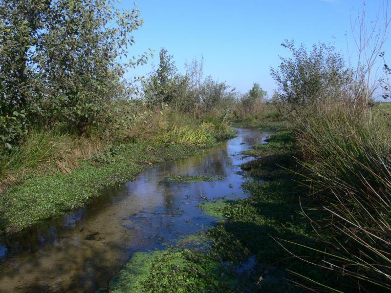
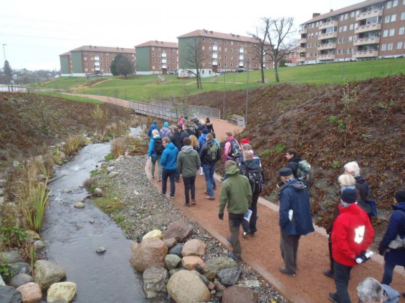
In Scotland, there has been a significant increase in awareness of, and focus on, hydromorphological issues over the course of the first cycle of river basin management. This has been helped by an initiative called the Water Environment Fund that I will talk about in more detail later on. SEPA and other partner organisations have been working with farmers, other rural land managers and local government authorities on a number of restoration projects. As well as delivering environmental benefits, these projects are playing an important role in increasing understanding within the organisations involved as well as spreading awareness more widely. However, there is still a long way to go to raise full awareness about the need to, and benefits of, improving hydromorphology.

At the EU level, the European Commission has made hydromorphology a key topic, emphasising the importance it attaches to hydromorphology. There are now a number of work streams under the Common Implementation Strategy looking at issues relating to hydromorphology. These include work by the ECOSTAT Working Group on comparing Member States’ understanding of good ecological potential, the improvement target for heavily modified water bodies.

3.      Has progress also been made on novel approaches to mitigate the impact of such degradation?

In Scotland, we have made significant steps in terms of improving the delivery framework and securing real improvements on the ground.  

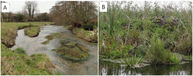
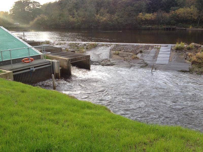
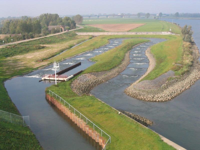
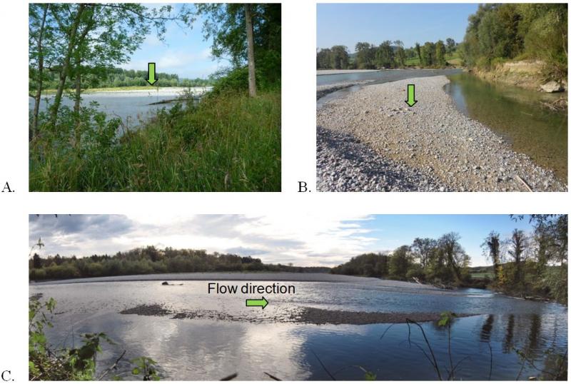
The majority of restoration projects supported so far have involved removing or easing barriers to fish migration. However, more natural river habitats have been restored in a small number of water bodies and we now need to build on these successes and increase the number and scale of restoration projects.

To help get restoration projects going, we have established a dedicated team in SEPA, known as the Water Environment Fund Unit.  The Unit administers funding provided by Scottish Government and running to around 5 million pounds per year. This is supporting initiatives by groups and individuals across the country. We are also working with local authorities and land managers in four catchment-based pilot projects. The pilots are aimed at demonstrating how improvements to river habitats can be combined with measures that help reduce flood risk.

For the second river basin management planning cycle, we are proposing to:

  • significantly increase work with public bodies, voluntary organisations and businesses to actively promote, encourage and develop improvement projects;
  • prioritise this effort according to where we expect improving river habitats will deliver the greatest benefits;
  • expand the role of the water environment fund in supporting measures to improve the physical condition of water bodies; and
  • work with managers of artificial structures on the beds, banks or shores of water bodies to ensure those structures are appropriately maintained or modified to reduce their impacts on the water environment.

Our 2nd draft river basin management plans published at the end of 2014 identified the need for this step change in effort and set out 3 scenarios on how hydromorphological impacts may be tackled over the next two planning cycles.

River restoration has to be balanced with the needs of important land uses. Where a river is surrounded by high value agricultural land or hemmed in by urban land uses, the scope for improvement will normally be considerably less than if the river were surrounded by low value land. One of the things we believe we need to develop to underpin our work is an effective way of communicating what we are aiming to achieve by way of hydromorphological improvement in different land use settings.

Concerning novel approaches at EU level, I can share my experience with the work done on the “intercalibration” of good ecological potential. This exercise is assessing how Member States compare with respect to the hydromorphological improvements they expect for:

  • rivers and lakes affected by water storage for uses such as hydroelectricity generation and drinking water supply;
  • rivers affected by modifications for land drainage and flood protection
  • estuaries and lagoons affected by modifications for a wide range of water and land uses.

With regard to water storage schemes, most countries involved (especially those with extensive hydropower) have well developed approaches for identifying what is required by way of mitigation to achieve good ecological potential.

At the moment, it appears that equivalent methods in relation to modifications of rivers for land drainage and flood protection are much less advanced in most countries, with a few exceptions such as Germany. This has implications for how far we can progress in comparing approaches.  It also suggests to me that working out how to address hydromorphological alterations still remains one of the big challenges for river basin planning across Europe.

4.      What are the key hydromorphological issues that currently need to be addressed in the EU Common Implementation Strategy of the WFD?

First of all, an important exercise on the agenda is the “intercalibration” of good ecological potential, which I mentioned above. This is providing an opportunity to share implementation practices and ideas, which is a very valuable process in itself.

Second, we still do not have a common understanding of “what good hydromorphology looks like” across Europe. I think there would be benefits of a further exchange of ideas and approaches on this topic. There is also a real gap in terms of ecological assessment methods that can indicate the ecological effects of hydromorphological alterations.

The ongoing work in the working group on Programme of Measures is providing an opportunity to share ideas and experiences on effective delivery frameworks for hydromorphological improvements, e.g. in terms of funding schemes, etc.

One additional item that needs to be addressed is ecosystem services. Some hydromorphological improvements (to rivers in particular) might have benefits in terms of reducing flooding; reducing river maintenance costs; or improving amenity or fisheries. Because of the awareness gap on hydromorphological issues, it is important to show what these wider benefits are from hydromorphological restoration measures. This is also about understanding synergies with other policy areas. For example, some improvements in floodplains can be achieved by planting more trees alongside rivers. Therefore, we need to make links to policies related to re-forestation and wood industry and show how they can work in practice. It is important to communicate broadly available evidence about possible synergies and spin-offs.

5.    What do you consider as valuable contributions of REFORM so far to river restoration practices and river basin management planning? What do you hope REFORM can deliver by the end of the project in 2015?

A lot of information has been put together in the REFORM WIKI. At the very technical level, the synthesis of understanding about river processes and interactions with aquatic plants and animals is already helping thinking about river hydromorphology and, for me in particular, has highlighted the importance of riparian vegetation. The case study outputs are also valuable in showing what can be achieved on the ground.

REFORM has been evaluating different ecological assessment systems. I am hopeful that the results of this work will provide a useful pointer to how the current gaps in such assessment systems in Scotland and elsewhere could be filled.

The WIKI already includes suggestions on measures that may be appropriate in relation to different hydromorphological impacts. This is very useful but I think the next step would be to pull together available guidance (e.g. from the case studies etc) for practitioners on how to design the measures in the field, including the “dos” and “don’ts”. I hope this might be possible but, even without it, the outputs are helpful in thinking about how to address impacts.

In the final phase of the project, I would suggest producing some sort of synthesis that brings together the ideas on restoration options and the potential ecosystem service benefits of restoration. This could perhaps be done using simple, stylised river catchments to represent a series of common hydromorphological impacts in different land use settings. This links back to what I said earlier about the need to communicate what can be achieved in different landscapes and the associated benefits.

Perhaps the only other wish from me is that REFORM finds some way of helping different audiences with different needs navigate easily to the information relevant to them. This is only an issue because the project has gathered so much information spanning a wide range of disciplines and levels of detail!

6.      How does EU-funded research in general contribute to the implementation of WFD and to what extent are scientific results adopted by Member States? How could REFORM be effective in the take-up of its results in its final year?

There are some obvious examples of the contribution of EU-funded research to the implementation of the WFD. One clear case is EU research done on priority substances and the development of quality standards. I might say that all EU countries have been affected by that. Also the EU FAME project had quite a big influence on the way we think about fish assessment. I believe many EU countries adopted the assessment methods of the FAME project, or, like us, modified or built on them in some way.

Overall, however, I would say that at least in the Scottish context, it is very much national research projects that have directly influenced WFD implementation. For example, we have commissioned our own research on good ecological potential, morphological assessment systems; river flows and ecological assessment methods. Any influence of EU projects on this work is likely to have been indirect – by influencing the researchers involved in the national research programmes. It is not possible for me to assess to what extent this has happened.

Concerning the outreach of REFORM, I believe that the WIKI is a good format to disseminate results. As I said earlier, I think that the current version would still benefit from developing a kind of “sign-posting” for different audiences, indicating the parts of the WIKI which you need to consult “if you are a practitioner” or “if you are a policy-maker working on the delivery framework”, etc.

In general, I think any project, EU or national, is well advised to identify and engage its target audiences at an early stage so that its outputs and their presentation best meet needs of those audiences. REFORM has made considerable efforts to do this and this is already reflected in the quality of the work to date.

Peter Pollard was interviewed on 07 January 2015 by Eleftheria Kampa (Leader of Dissemination and Stakeholder Involvement of REFORM, Ecologic Institute).

For further information: 

Eleftheria Kampa, Ecologic Institute

Rewidening and rewilding the Thur river (Switzerland)

With its source in the Alps and its mouth close to the Rhine falls, the Thur once was a dynamic braided river flowing through the Swiss Plateau. However, to gain arable land and decrease the impacts of floods, most parts of the river were constrained in a straight, unique channel and surrounded by high levees at the end of the 19th century. Since this time, human perception changed and we now understand that human constructions alone cannot prevent the society from floods impacts. Today, in Switzerland a strong political willingness exists to increase the space available for rivers and to rejuvenate their wilderness, with the hope to improve their protecting role against floods and their ecological state at the same time. In 2002, the rehabilitation of the Thur was one of the prominent restoration programmes in Switzerland. Several research projects used this opportunity as a large-scale experiment to increase the understanding about river functioning, e.g. the Rhone-Thur project (Eawag, WSL, ETHZ, EPFL, 2005) and the RECORD project (Schirmer et al. 2014). More than 10 years later it is time to evaluate the mid-term ecological effects of this large restoration project, so it became one of REFORM’s 20 case studies (see figure 1).

Figure 1: The Thur river is situated in the north east of Switzerland. It is a lowland river of 130 km with a 1730 km2 catchment area, and discharges into the Rhine river. It is a river free of dams and artificial reservoirs, showing water level fluctuations close to unregulated alpine rivers. This river has been regulated to serve agricultural and flood protection. Recently in the downstream part a restoration programme was implemented to rehabilitate the river over a distance of 2km (see green dot on the figure).

Human interventions and uses

Before river engineering in 1890, the river braided, gravel bars were frequent, islands were present, natural alluvial forest accompanied the river. The complexity and heterogeneity of the habitats were maintained by the natural dynamics of the river itself. Its regulation created a monotonous channel surrounded by high levees and accompanied by embankments which fixed the river. New agricultural land was gained behind the levees for crop production, and between the levees and the embankments for grazing. At the same time, villages and cities were better protected from flood events during which discharge can raise to 1130 m3/sec (in 1999), far from the mean annual flow of 47 m3/sec. The stabilisation of the river bed also permitted to extract drinking water filtrated in the sediment. These human interventions had direct consequences on the hydromorphological conditions, the ecosystem functioning, and its biodiversity. Gravel bars disappeared, secondary channels terrestrialised, characteristic riverine species became rare, floodplain related species disappeared and the complexity of the system was largely reduced (see figure 2).

Figure 2: A. Thur river embanked, flowing from the Swiss prealps. B. Embankments disposed all along the river channel (orange arrow) to stabilise the river and fix its shape. C. Embankments along the river (lower orange arrow) followed by narrow surface available for domestic animal feed (red arrow), and limited by high levees (upper orange arrow) with agricultural surfaces or forests behind the levees. The same scheme is valid for both sides of the river. (photos: P.Reichert and A.Paillex, Eawag)

Restoration

In 2002, a 1,5km section of the river and its floodplain was intensively restored. The river was widened on one side of the main river channel. Embankments along the right side of the river were removed to provide more space to the river in an area where levees were absent already before restoration (see figure 3). Additional artificial structures were added to enhance the ability of the river to braid. The dynamic processes were expected to return, with natural patterns of erosion and deposition, better connection between the main river channel and the floodplain, and recreation of secondary channels. Overall, an increase of instream and terrestrial habitats diversity was expected, leading to an increase in biotic richness and diversity, both in the river and on the banks.

Figure 3: Overview case study site A. Recreated gravel bar on the left side of the river (green arrow), and presence of wood within the main river channel. B. Part of the restored site with the main river channel on the left of the photo, a stagnant water body and alluvial forest on the right with gravel bars between (green arrow). C. Downstream view from the middle part of the restored site (photos: A. Paillex and H. Mottaz, Eawag).

Measuring restoration success - What comes next?

As a result from river restoration, we can observe that gravel bars were recreated, secondary channels appeared, and zones of erosion and deposition now co-exist at the scale of the restored reach. A positive effect of this enhanced naturalness is an increased number of people visiting the river, especially on sunny days. This is supported by an easier access to the river and more opportunities for recreational activities. Less visible, but measurable with appropriate methods, are the biological improvements in the restored reach compared to regulated stretches. The richness in benthic invertebrates, fish, ground beetles, aquatic vegetation and floodplain vegetation has increased in the restored section (see table 1). According to a valuation of richness and of threatened and invasive species, the improvement was important for fish and ground beetles, intermediate for floodplain vegetation, and less significant for benthic invertebrates and aquatic plants. A positive effect is that threatened species (e.g. the fish Chondrostomas nasus) took advantage of this restoration project, while a negative side effect is the occurrence of an invasive aquatic plant in the restored site (i.e. Elodea nuttallii). A combined valuation of biological and morphological conditions indicates an overall positive effect of restoration on the ecological state of the river.

However, there is still a lot to do to sustain this improvement for the long term. Today, we may have to prevent invasive species from colonising the recovered habitats, and improve the water quality to increase the biological success. Finally, it is important to recall that this restored part is only 1.5 km long while the majority of the remaining 130 km of the river are still totally embanked.

Table 1:Number of taxa observed in a degraded and a restored reach of the Thur river.

Cited literature and further information:

Eawag, WSL, ETHZ, EPFL, 2005: Integrales Gewässermanagement - Erkenntnisse aus dem Rhone-Thur Projekt http://www.rivermanagement.ch

Schirmer, M., Luster, J., Linde, N., Perona, P., Mitchell, E. A. D., Barry, D. A., Hollender, J., Cirpka, O. A., Schneider, P., Vogt, T., Radny, D., and Durisch-Kaiser, E. 2014: Morphological, hydrological, biogeochemical and ecological changes and challenges in river restoration – the Thur River case study, Hydrol. Earth Syst. Sci., 18, 2449-2462, http://www.hydrol-earth-syst-sci.net/18/2449/2014/hess-18-2449-2014.html


Authors:

Amael Paillex*, Ivana Logar, Mario Schirmer, Nele Schuwirth*, Rosi Siber*, Hong Yang*, Peter Reichert*

Eawag, Swiss Federal Institute of Aquatic Science and Technology, *System Analysis, Integrated Assessment and Modelling,Water Resources and Drinking Water, Environmental Social Sciences, Überlandstrasse 133, P.O. Box 611, CH-8600 Dübendorf, Switzerland

For further information: 

Amael Paillex